The Procyon 800E drone helicopter has arrived!


.

Why Choose A Helicopter Drone?

Helicopter Advantages

Robust VTOL Performance

Logo Helicopter Weight

Helicopter drone hover performance is unmatched by any other vehicle type.  More power and heavier payloads than multirotors.  Far longer hover duration than VTOL planes, up to 45 minutes compared to often just 2. Plus unmatched stability in wind compared to either alternative, they can tolerate high wind turbulence, while facing in any direction.

Fast Forward Flight

Logo Fast Forward


Helicopters benefit from reduced power consumption at cruise speed, offering far greater range than multirotors for applications requiring fast forward flight such as mapping or line inspection.  They can even offer better wind penetration than many airplane designs, allowing higher ground speed on upwind legs.

More Efficient Flight Plans

Logo Square Corners

Capable of square corners, helicopters can make more efficient flight paths when flying grid patterns than airplanes.  This results in quicker missions, but also allows mapping right to the edge of obstacles and borders.

Longer Flight Range

Logo Long Distance

All of this combines to give helicopters longer flight duration and range, especially when hovering and forward flight must be combined into a single mission, or when heavy payloads must be lifted.

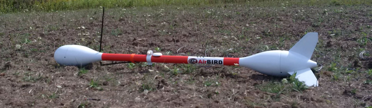
Compact Transport and Rapid Deployment

Logo Transport


Helicopter drones require less space for transportation than comparable multirotors and airplanes.  And the deployment process is faster, simply unfold the blades, a helicopter can be ready to fly in seconds.
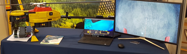
Mature Technology

Logo Technology

Helicopter technology has been developed and perfected in the full-scale aviation industry decades ago.  While small-scale model helicopters have been made for over 20 years.  The technology is mature and proven, compared to multirotor and VTOL airplane drones.


(more…)

Aren't Helicopters Hard To Fly?
Our Blog

Latest Updates

We are very excited to be participating in the Google Summer of Code program this year, in combination with the Ardupilot Organization, and of course Google!  GSoC is a program intended to get University students from around the world involved with open source projects, which helps them grow their coding experience, and hopefully become lifelong… Read More

Continue Reading

We are pleased to announce that Robert Lefebvre has been asked to present a class again at the Interdrone conference in Las Vegas, September 6-8 2017. It covers how Robotics generally work on helicopters. In addition, you can also get to know how AI technology works, especially on trading platforms. Platforms like the bitcoin system are AI-driven crypto trading bots that allow traders to execute the trade automatically with its cutting-edge algorithm. By having a look at the bitcoin system review, you can get to know what people think about it. Hence, the class will be a great insight for those who are looking to know more about robotics. This year’s topic will be UAV Systems Comparison - Planes, Frames and Autopilots. This session will compare and contrast the large variety of different aircraft types. It will cover… Read More

Continue Reading

I am pleased to announce that NOVAerial Robotics Inc. has entered acquisition discussions with Global UAV Technologies Ltd, a Canadian-based UAV consortium that is rapidly expanding with a series of well-planned acquisitions.  Their goal is to assemble a number of companies to service the high-end of the commercial UAV industry. I would like to assure… Read More

Continue Reading

One of NOVAerial’s latest customers, GeoInspect Ltd, is presenting their recently delivered Procyon 800E Helicopter UAV system at the Drone & Tech Expo in Ireland this weekend.  GeoInspect will be installing a YellowScan Surveyor Lidar scanning package onto the UAV Helicopter for aerial surveying work. Just another example of the applications to which drone helicopters… Read More

Continue Reading

Recently, NOVAerial Robotics Inc. has been working on operational development of airborne magnetometer surveying with several customers. This technique is typically used by the mining industry to search for magnetic anomalies in the ground which could indicate the location of valuable mineral deposits. Historically, this has been done either with surveyors walking with a hand-held… Read More

Continue Reading

NASA is now planning on using a UAV in addition to the Rover in order to explore Mars.  The reasons are very simple, and parallel the desire to use UAV’s on earth.  Having a camera in the air, instead of being stuck on the ground, allows for better perspective to see details of the terrain.… Read More

Continue Reading
View Blog